

The Site: Kamid el-Loz
 Tell Kamid el-Loz, ancient Kumidi, is situated near a modern village by the same name, located in the fertile highland of the Baqa'a-plain, c.a. 950 m above sea level, between Mount Lebanon to the west and the Anti-Lebanon mountains to the east. The tell overlooks an important intersection of two central trade routes between Egypt, through the Southern Levant and to Anatolia and from Damascus, Syria to Tyre, Sidon, and Beirut at the coastal plain.
The relevant excavations for PEKULI took place under the direction of Rolf Hachmann (Saarbrücken University) from 1966 to 1981, when it was abandoned because of the civil war. Since 1997 the excavations have been renewed under the direction of Marlies Heinz (University of Freiburg).
The tell was inhabited since the late Neolithic (5th millennium BC) and experienced a special bloom in the Middle Bronze Age (about 2000-1600 BC) and Late Bronze Age (about 1600-1200 BC). The Late Bronze Age Kumidi appeared several times in the ‘Amarna Letters’ where it is mentioned as the seat of an administrator and later an Egyptian governor, Puhuru, during the regimes of Pharaoh Amenhotep III and Akhenaten (14th century B.C.). In the Iron Age (1200-600 BC) the settlement loses its importance. The most important finding of the subsequent Persian period (600-330 BC) is the large cemetery, which was found on the tell.
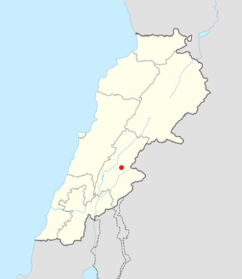
Location of the site in Lebanon. Modified from: Kamid al lawz is located in Lebanon by NordNordWest, Lizenz: Creative Commons by-sa-3.0 de